Idaho Weather
Current north fort myers Weather
| ||||||||||||||||||||||||||||||||||||||||||||||||||||||||||||||||||||||||||||||||||||||||||||||||||||||||||||||||||||||||||||||||||||||||||||||||||||||||||||||||||||||||||||||||||||||||||||||||||||||||||||||||||||||||||||||||||||||||||||||||||||||||||||||||||||||||||||||||||||||||||||||||||||||||||||||||||||||||||||||||||||||||||||||||||||||||||||||||||||||||||||||||||||||||||||||||||||||||||||||||||||||||||||||||||||||||||||||||||||||||||||||||||||||||||||||||||||||||||||||||||||||||||||||||||||||||||||||||||||||||||||||||||||||||||||||||
north fort myers Quick Forecast
| ||||||||||||||||||||||||||||||||||||||||||||||||||||||||||||||||||||||||||||||||||||||||||||||||||||||||||||||||||||||||||||||||||||||||||||||||||||||||||||||||||||||||||||||||||||||||||||||||||||||||||||||||||||||||||||||||||||||||||||||||||||||||||||||||||||||||||||||||||||||||||||||||||||||||||||||||||||||||||||||||||||||||||||||||||||||||||||||||||||||||||||||||||||||||||||||||||||||||||||||||||||||||||||||||||||||||||||||||||||||||||||||||||||||||||||||||||||||||||||||||||||||||||||||||||||||||||||||||||||||||||||||||||||||||||||||||
3 Hourly Forecast
|


Back to top
Interactive Weather
Click on one of the interactive weather sites below to go to the
site in a new window.
Back to top
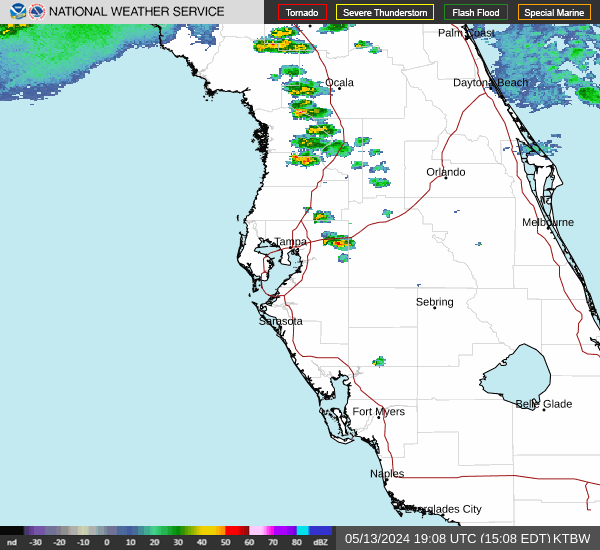
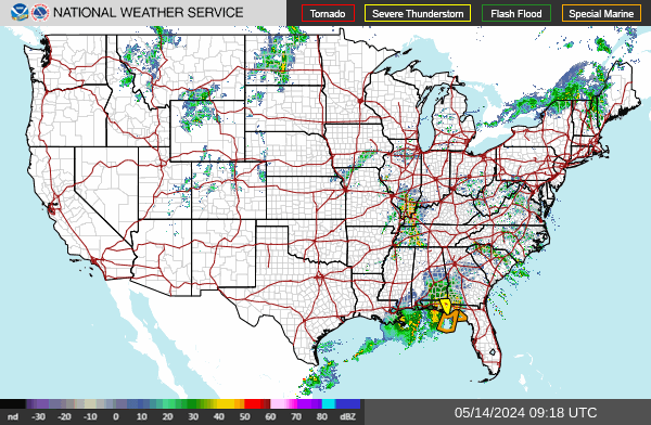
Radar Maps
Click on an image to display a larger image in a new window, then click on your area of interest.
 |  |
Back to top
Satellite Imagery
Click on an image to display a larger still image in a new window.


Back to top
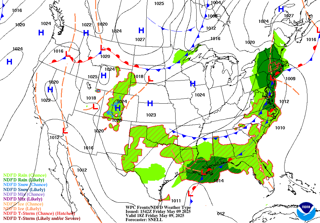
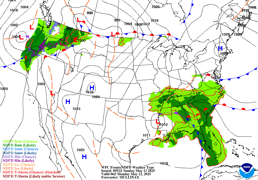
Forecast Maps
Short Range Forecast

Animated
Click on an image below to see a larger map in a new window.
(Or install the Imagus extension to hover to see a larger map.)
 6 Hour | 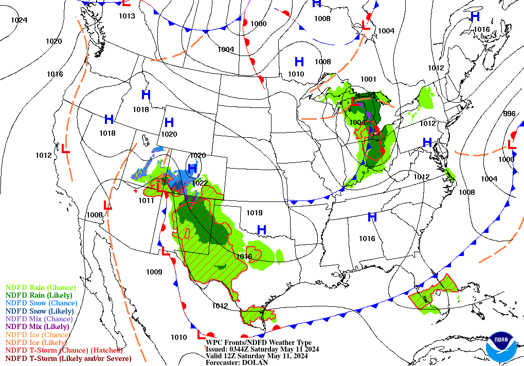 12 Hour | 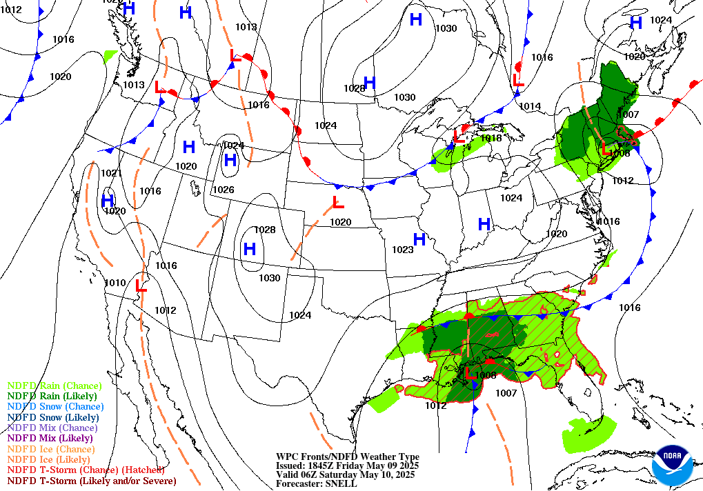 18 Hour | 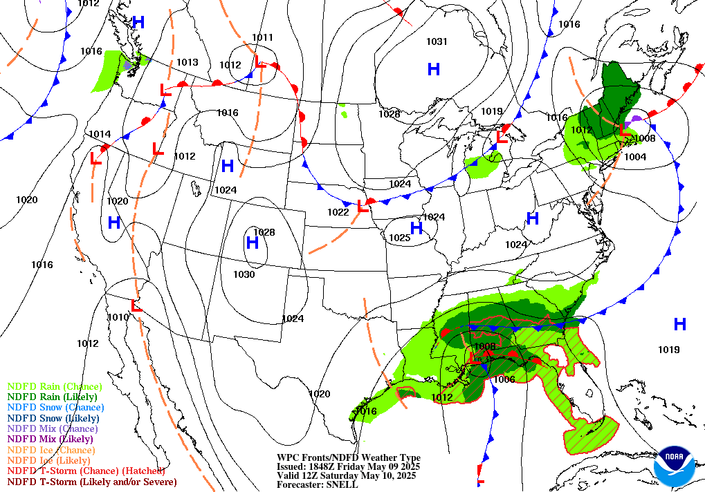 24 Hour |
 30 Hour |  36 Hour | 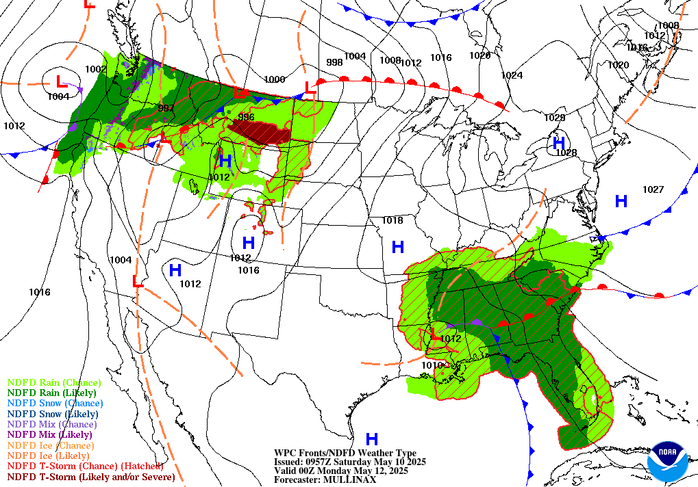 48 Hour | 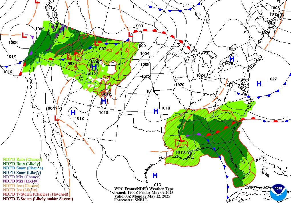 60 Hour |
Medium Range Forecast
Click on an image below to see a larger map in a new window.
(Or install the Imagus extension to hover to see a larger map.)
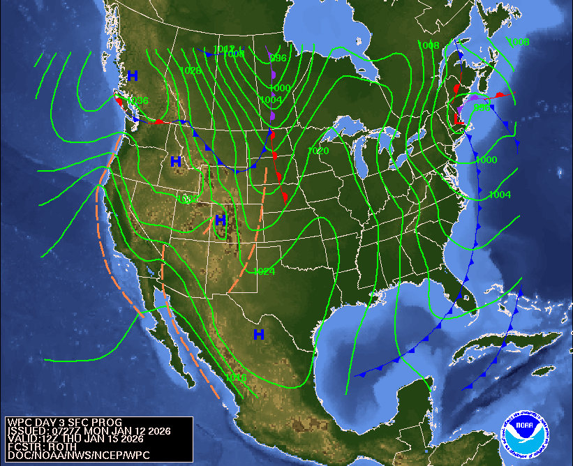 Day 3 | 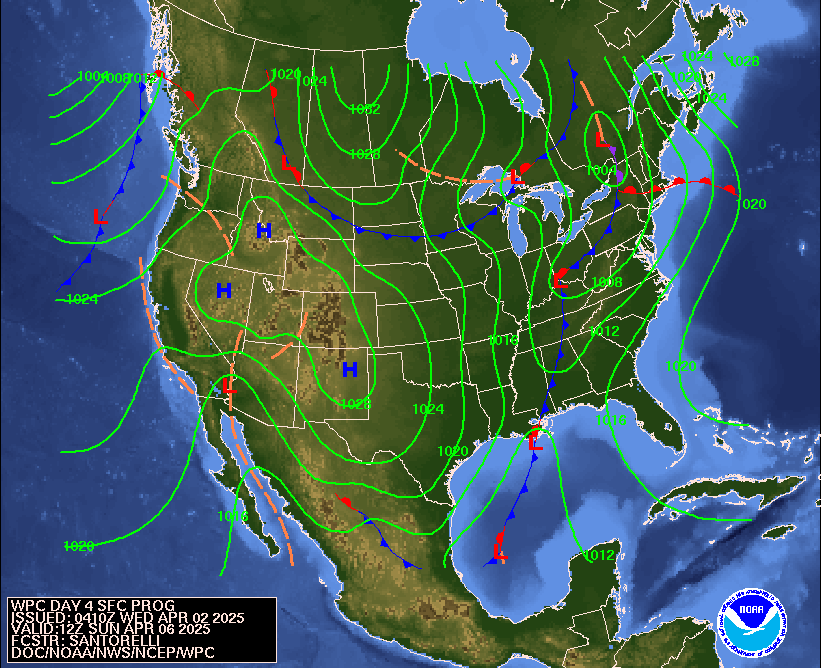 Day 4 | 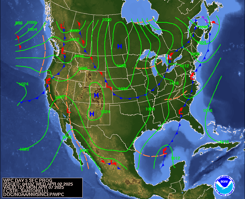 Day 5 | 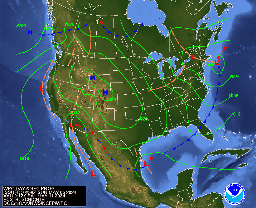 Day 6 | 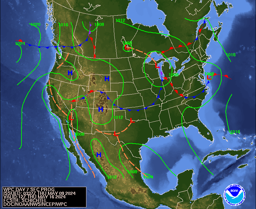 Day 7 |

Back to top
Temperature Forecast
Click on an image below to see a larger map in a new window.
(Or install the Imagus extension to hover to see a larger map.)
Maximum
Today  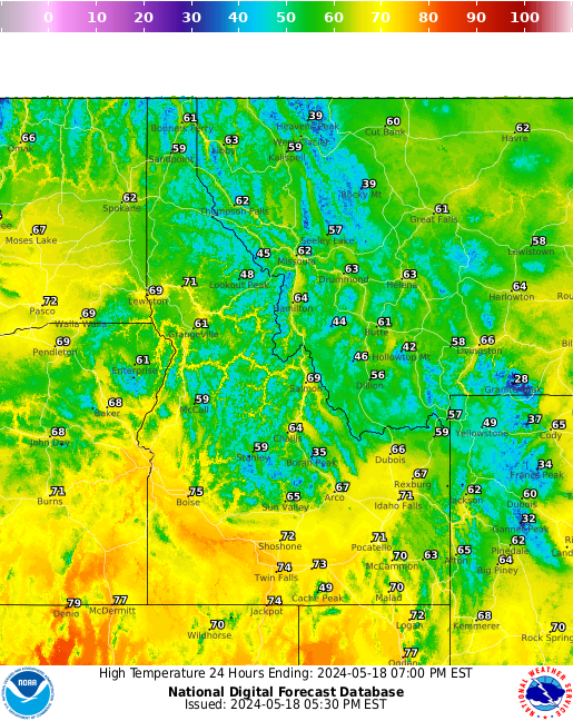 | Tomorrow 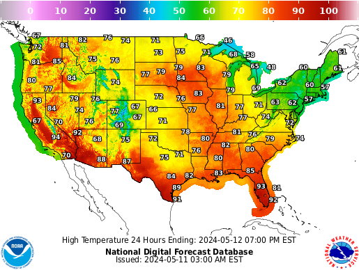 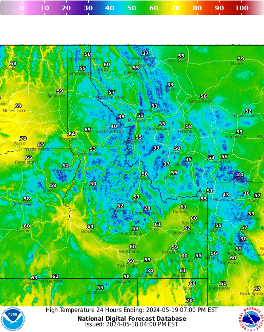 | Day 3  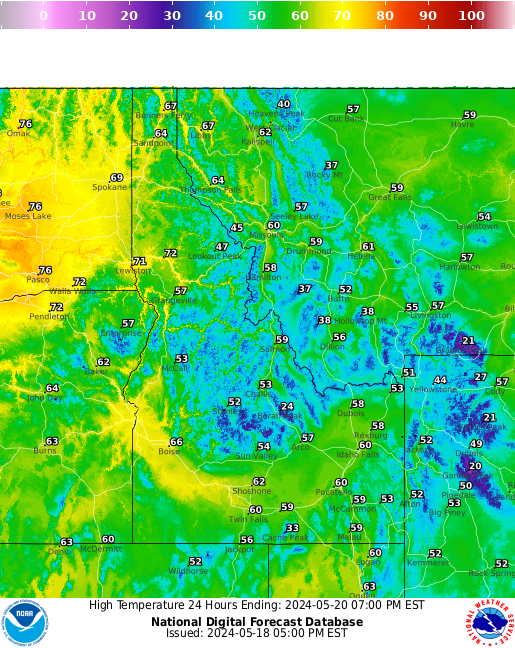 | Day 4 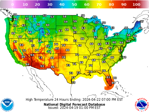  | Day 5   | Day 6   | Day 7 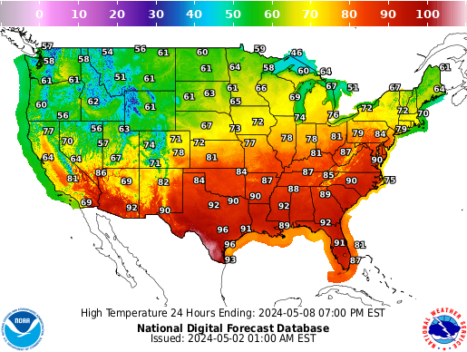 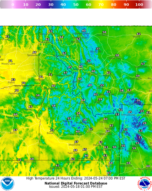 |
Minimum
Tonight  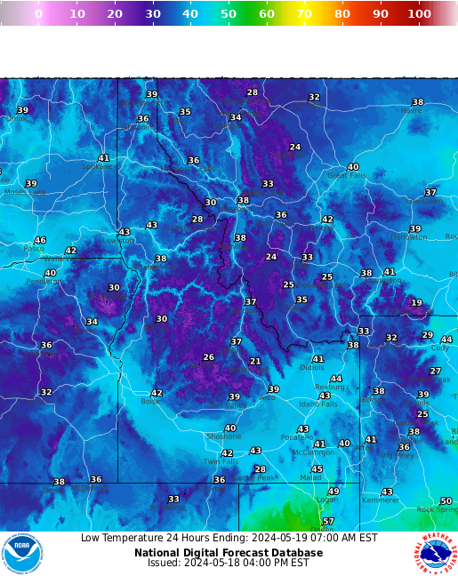 | Tomorrow Night 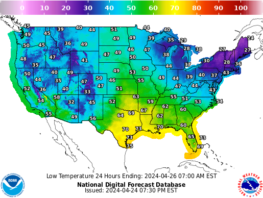 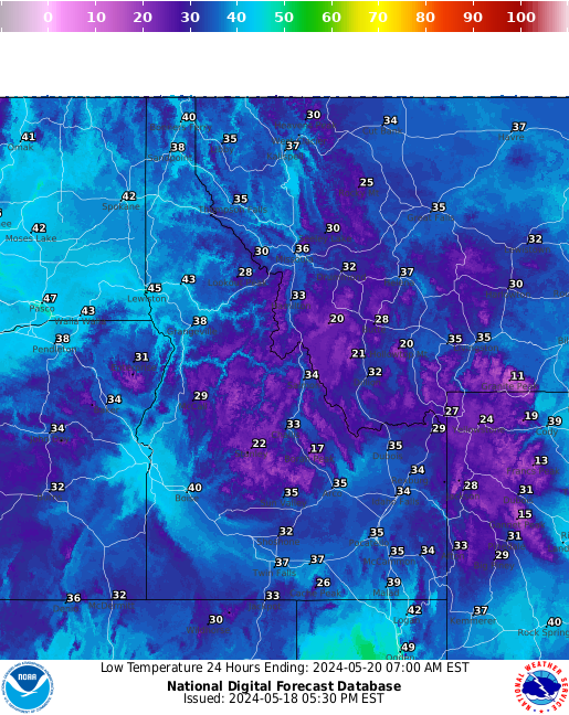 | Night 3  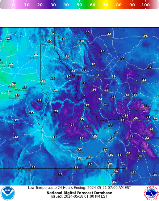 | Night 4 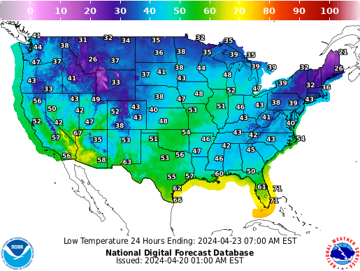 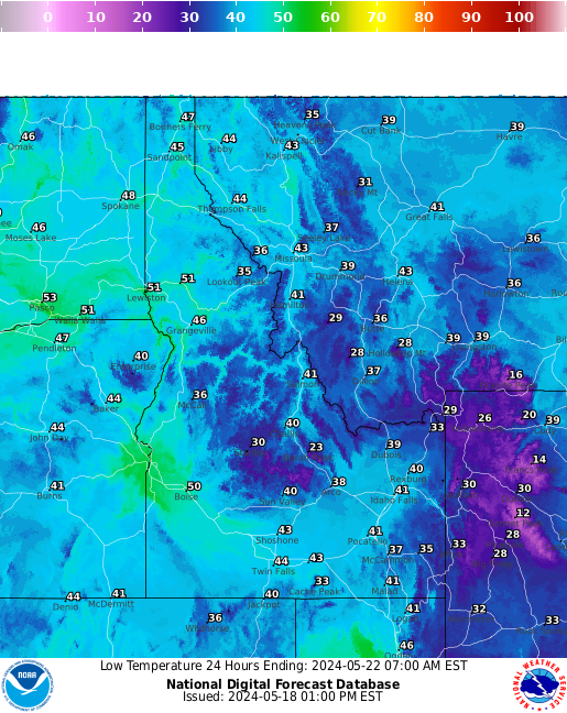 | Night 5  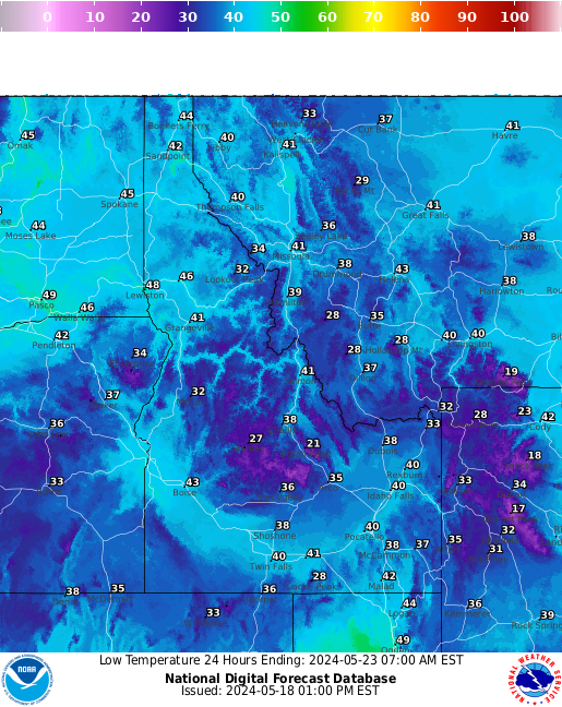 | Night 6 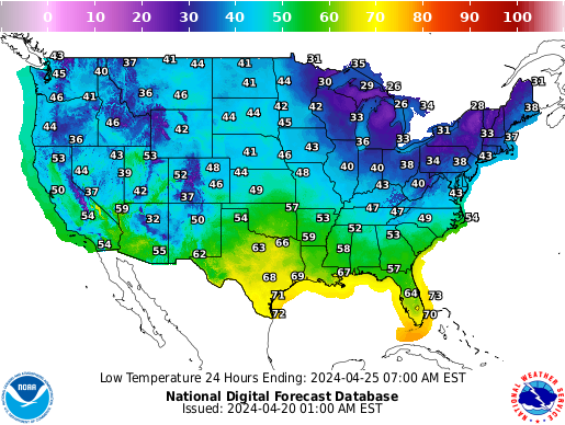 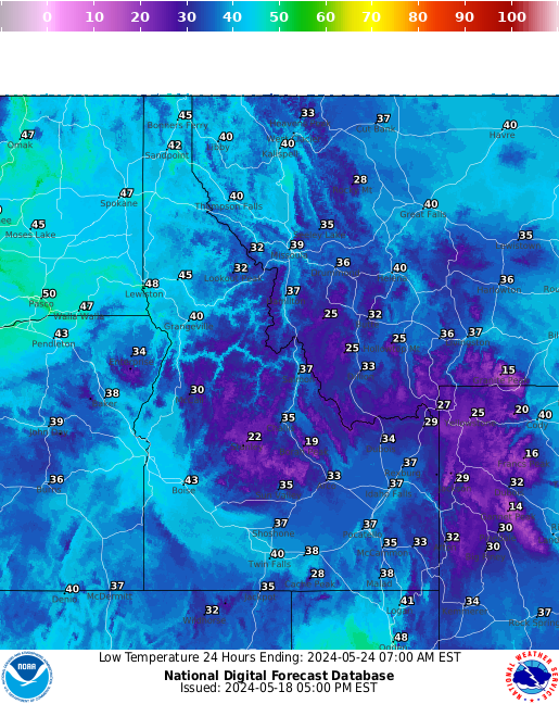 |
Back to top
12 Hour Precipitation Probability Forecast
Click on an image below to see a larger map in a new window.
(Or install the Imagus extension to hover to see a larger map.)
Hour 12 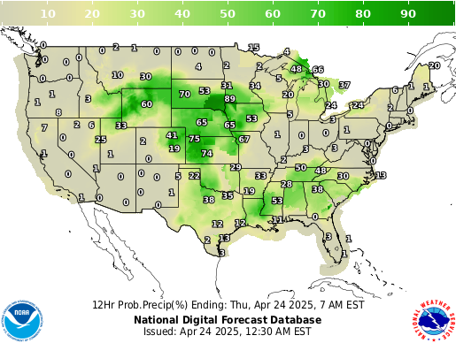 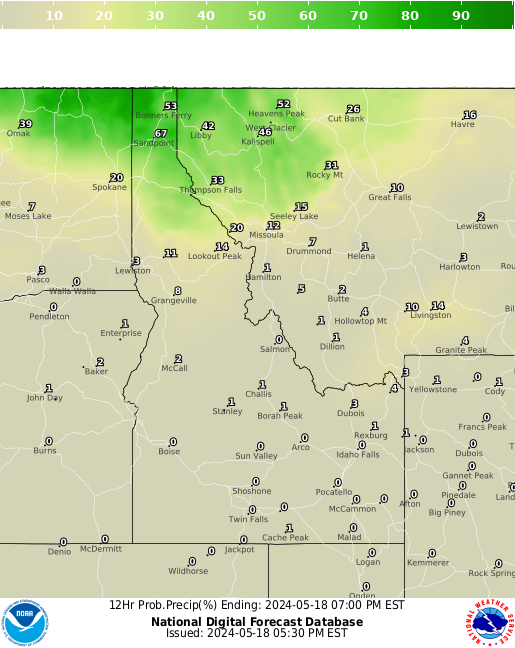 | Hour 24 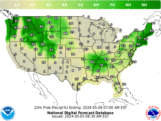 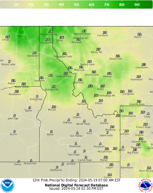 | Hour 36 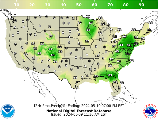 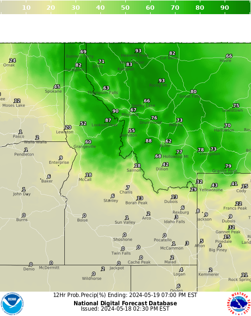 | Hour 48 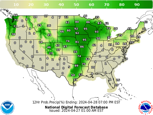 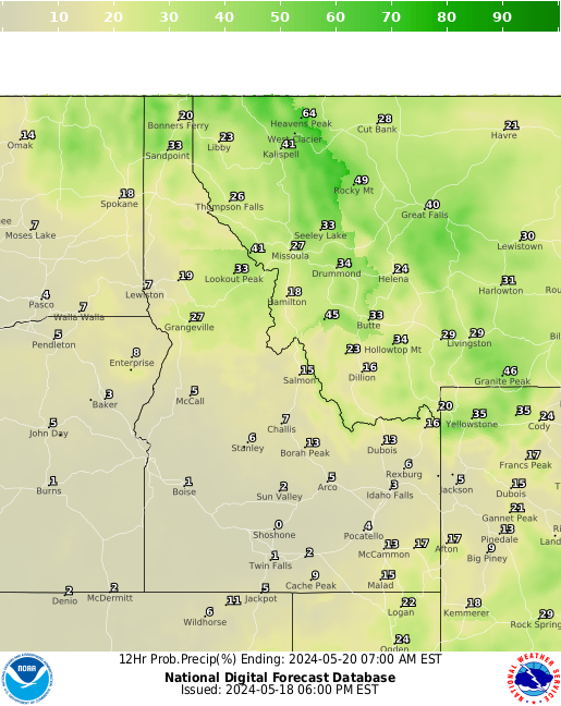 | Hour 60 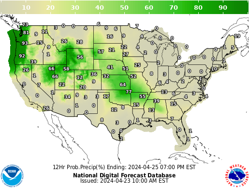 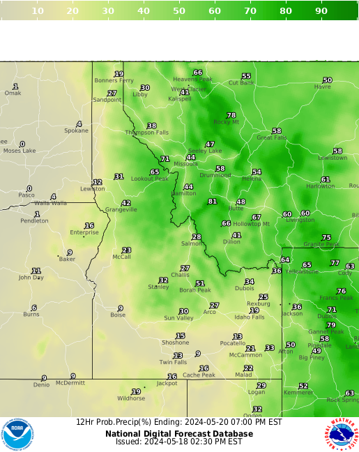 | ||||
Hour 72 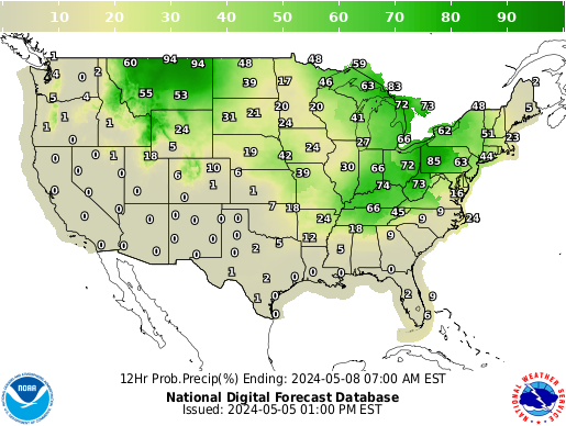 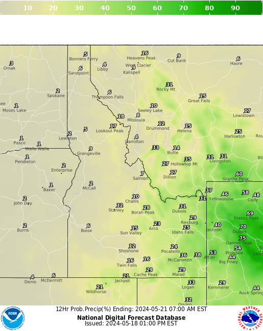 | Hour 84 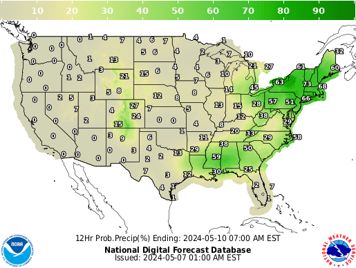 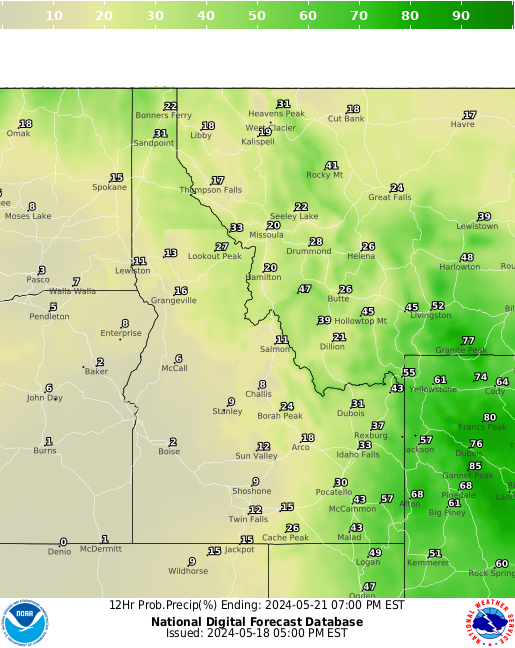 | Hour 96 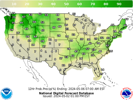 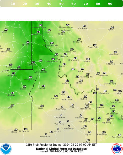 | Hour 108 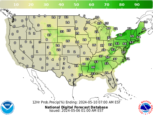 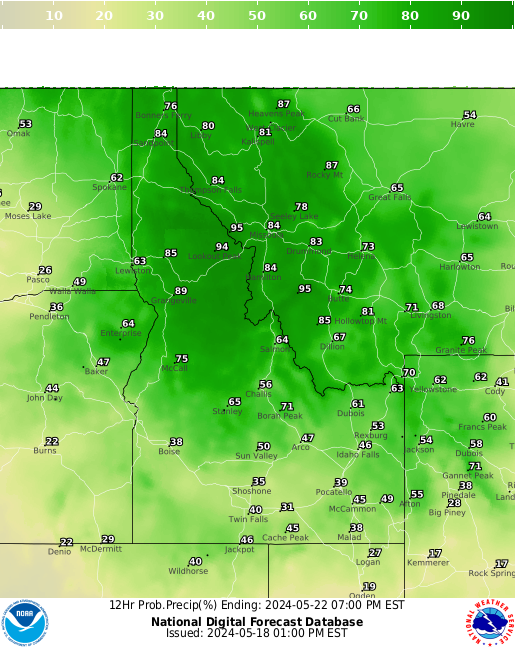 | Hour 120 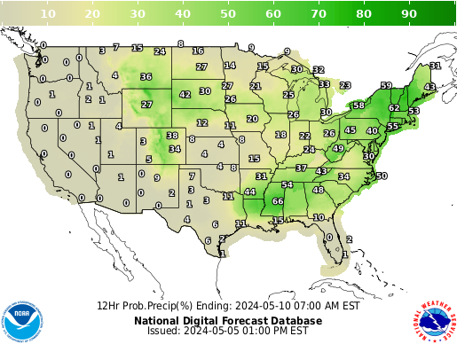 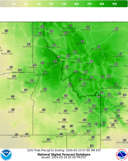 |
Back to top
6 Hour Rain Amount Forecast
Click on an image below to see a larger map in a new window.
(Or install the Imagus extension to hover to see a larger map.)
Hour 6 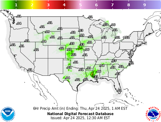 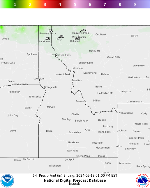 | Hour 12 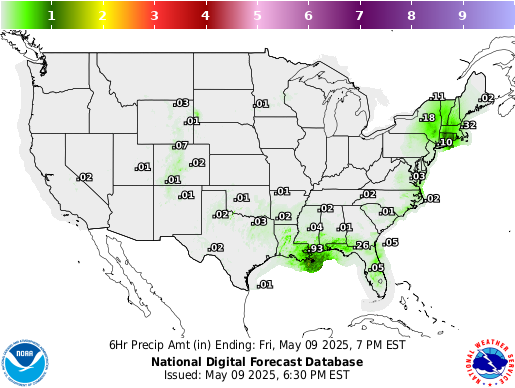  | Hour 18 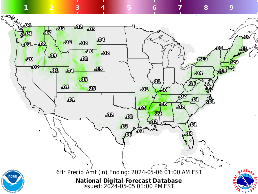 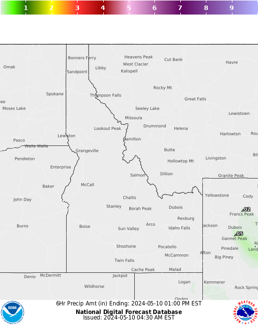 | Hour 24  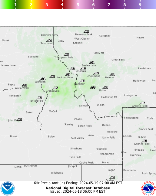 | Hour 30 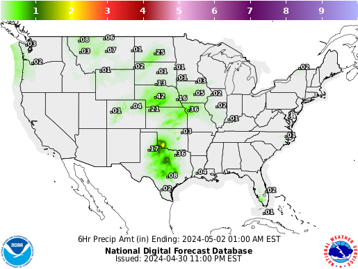 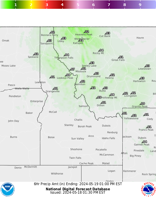 | ||||
 Inches Inches cm cm | ||||||||
Hour 36 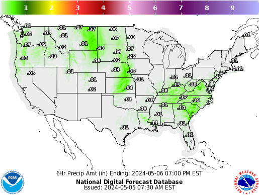 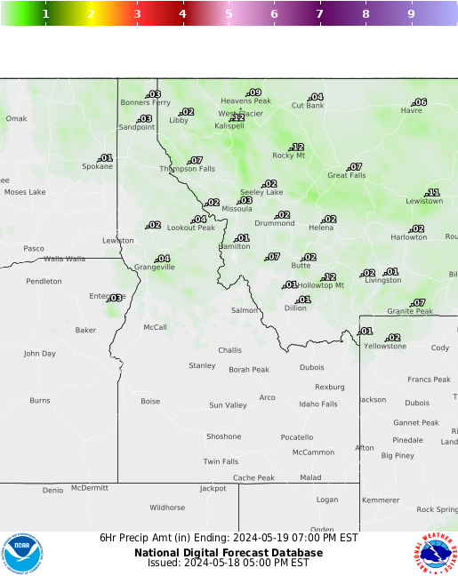 | Hour 42   | Hour 48 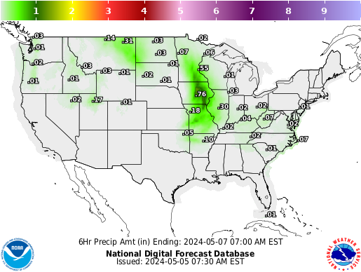 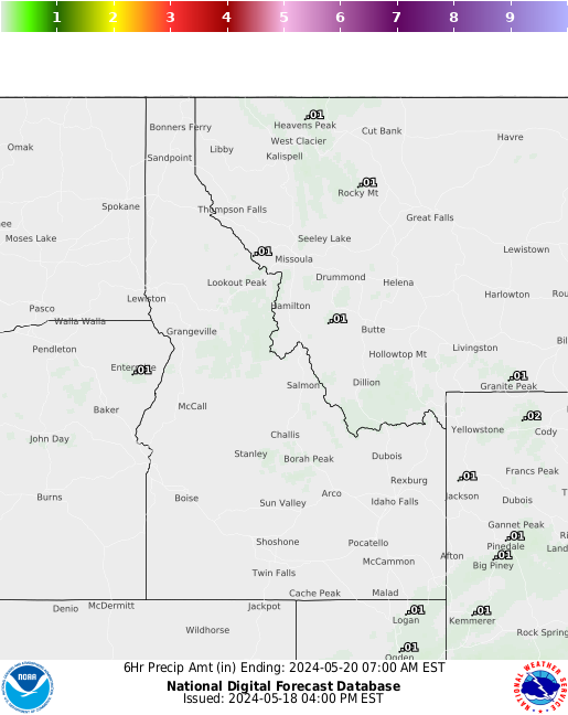 | Hour 54 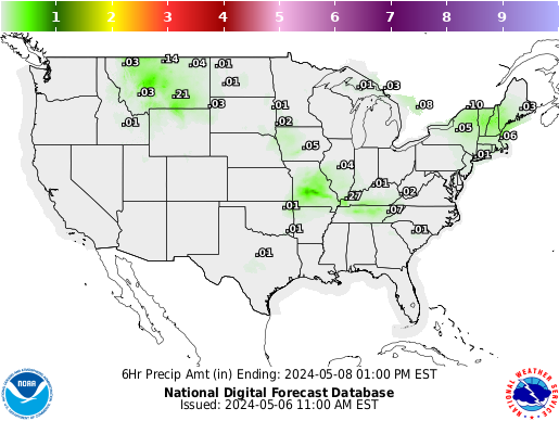 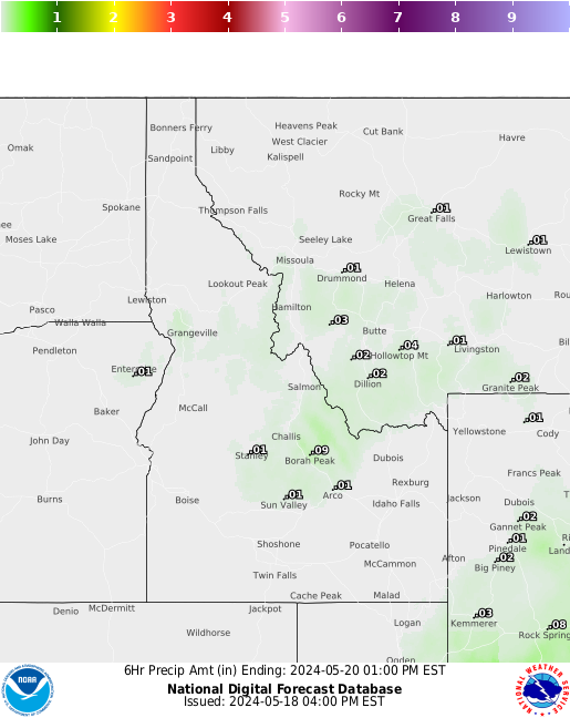 | Hour 60  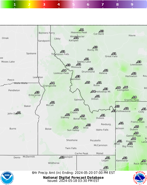 | ||||
Back to top
6 Hour Snow Amount Forecast
Click on an image below to see a larger map in a new window.
(Or install the Imagus extension to hover to see a larger map.)
Hour 6 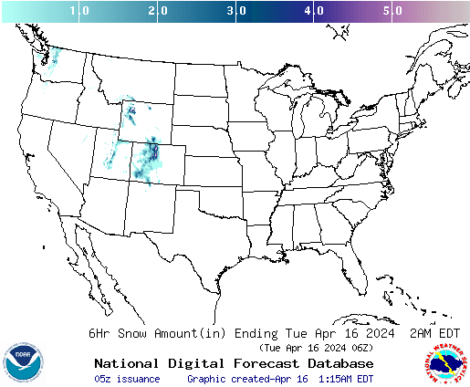 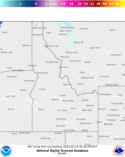 | Hour 12   | Hour 18   | Hour 24 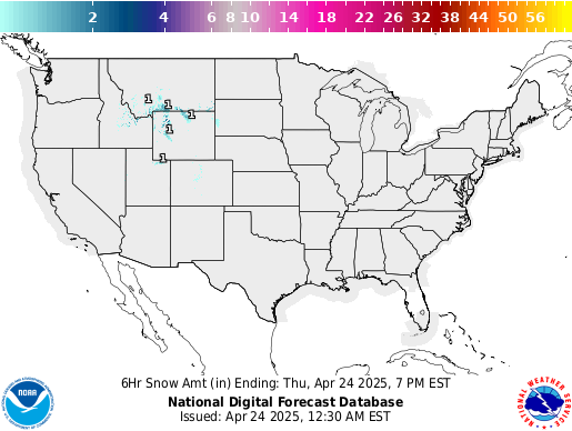 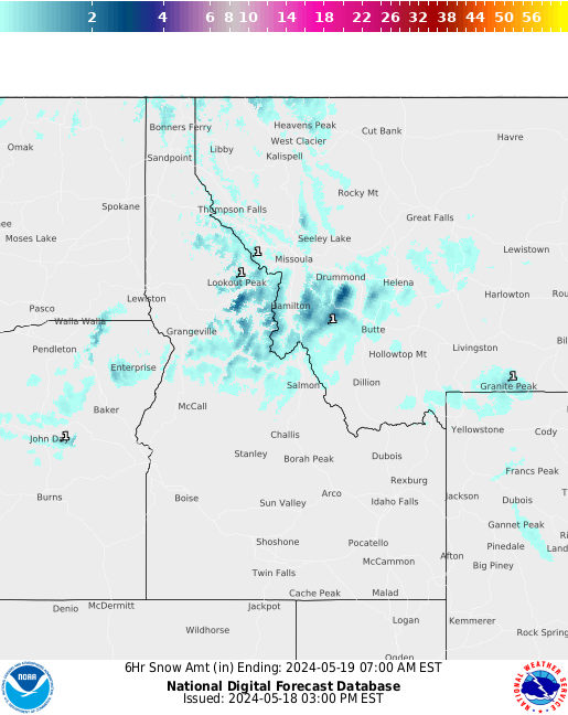 | Hour 30 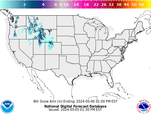 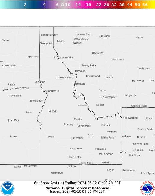 | ||||
 Inches Inches cm cm | ||||||||
Hour 36   | Hour 42 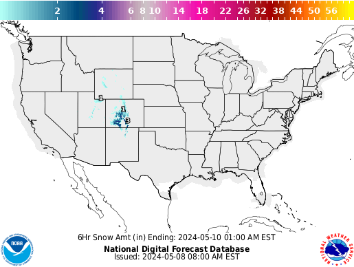 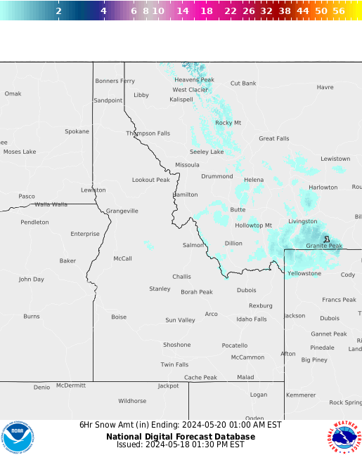 | Hour 48 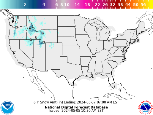 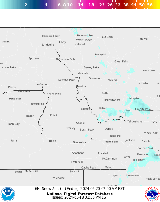 | Hour 54  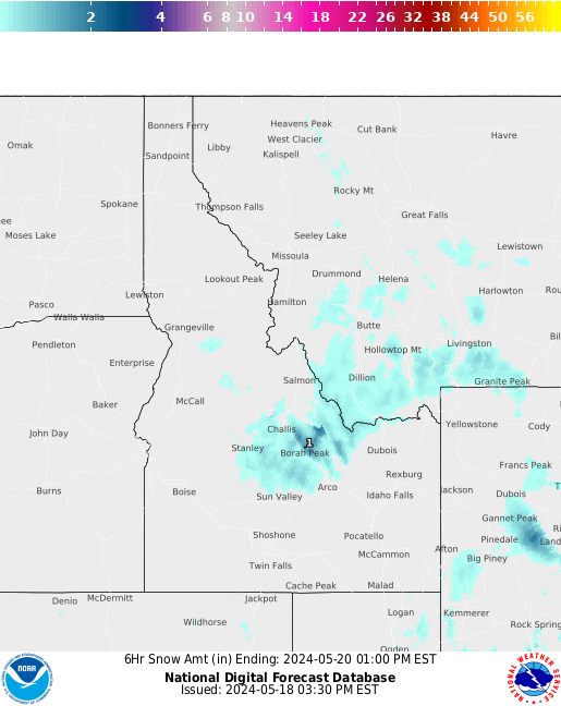 | Hour 60  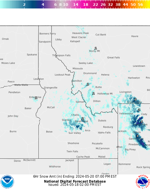 | ||||
Back to top
6 Hour Ice Accumulation Forecast
Click on an image below to see a larger map in a new window.
(Or install the Imagus extension to hover to see a larger map.)
Hour 6 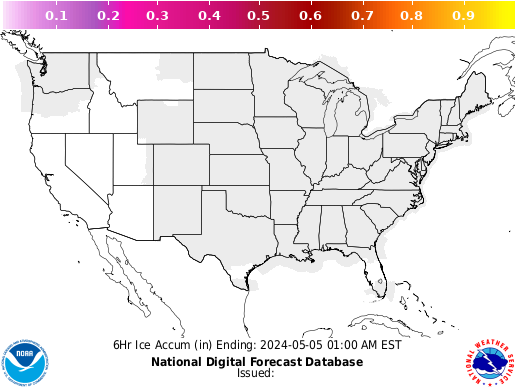 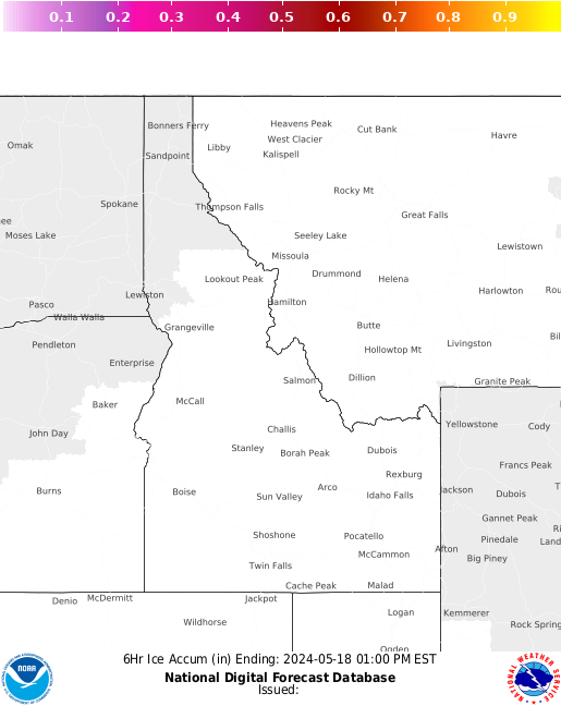 | Hour 12  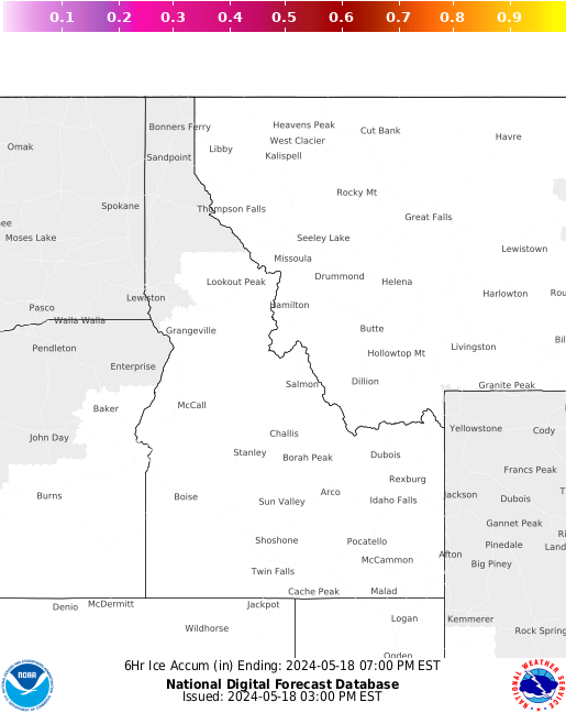 | Hour 18   | Hour 24   | Hour 30   | ||||
Hour 36   | Hour 42   | Hour 48   | Hour 54   | Hour 60   | ||||
Back to top
Drought
Click on a drought chart to go to the US Drought Monitor in a new window.


Back to top
Severe Weather Alerts
Click on a map below to go to Accuweather's Severe Weather in a new window.


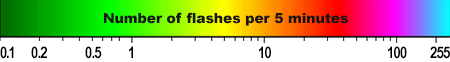
Recent Lightning Strikes
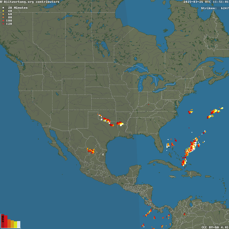
Back to top
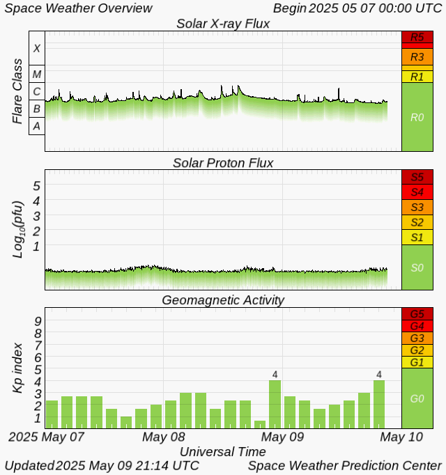
Solar Weather
Click on a graph below to go to more information in a new window.
LASCO/C2 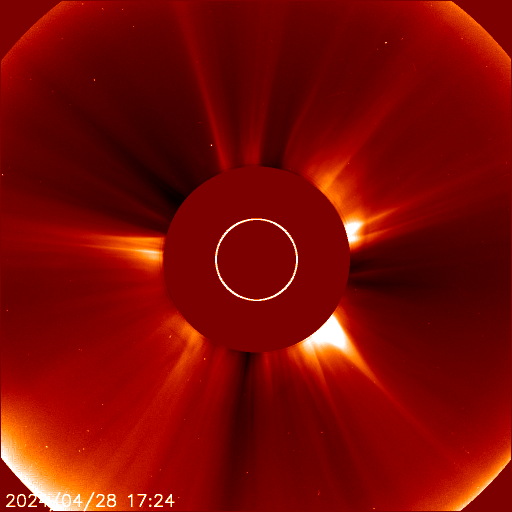 | LASCO/C3 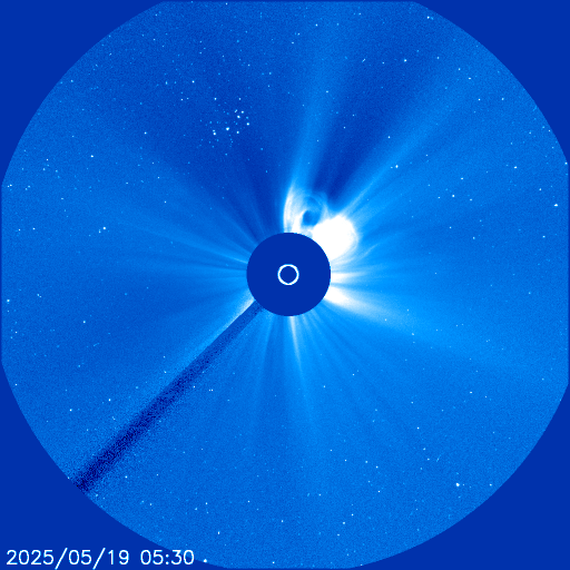 |
ENLIL Spiral
Magnetic sector boundaries and CME events
Magnetic sector boundaries and CME events


Back to top
Weather Resources
GeneralThe Storm Prediction Center offers official convective outlooks, discussions, watches, warnings, and more on their website for severe weather. The Weather Prediction Center offers outlooks of general surface analysis forecasts and national precipitation forecasts. The National Hurricane Center offers outlooks and tools for the tropics. The Climate Prediction Center offers long term outlooks for the U.S. including weekly, monthly, and seasonal forecasts. The Space Weather Prediction Center offers space weather analysis and forecasts. Computer ModelsGeneralCollege of DuPage: For those who are looking for an easy to use, quickly updating website. Overall, this is a very solid website with several parameters as well as above average graphics. There are national and regional views. The wind barbs / streamlines are highly detailed on this website. Ease of use is relatively smooth. Several models are available here, including the HRRR, RAP, NAM, 4km NAM, SREF, GFS, GEFS, ECMWF, and CFSv2 models are offered here. However, the GEM is not included. There is also detailed forecasted model skew-t's offered here, using SHARPpy, a big bonus. Twister Data: For those who are forecasting severe weather setups. This website has been around for several years and for its time when it was launched, had great graphics. Several severe-weather parameters are offered here, along with the moisture/temp + wind barb overlay. It is simple and easy to use as well. The RAP, NAM, and GFS are offered here. There are also model-forecasted soundings and hodographs. Tropical Tidbits: For those who want great graphics and several different model choices. This website offers several different models including the GFS, EURO, CMC, NAVGEM, HWRF, HWRF-P, GFDL, GFDL-P, NAM (32km, 12km, 4km), WRF-ARW, WRF-NMM, RGEM, HRRR, CFS, CanSIPS, NMME. There is also ensemble data offered here, including the EPS, GEFS, and GEPS. NCEP: For those who are conventional. The National Weather Service offers some of the American models on their website, including the GFS, NAM, Hi-res NAM, WRF, RAP, HRRR, & SREF. There are mostly national views, however there are some regional views as well. The ease of use is average and the graphics are average as well. However, the graphics are overall clean and have been around for quite a while for users that are familiar to these. Penn State eWall: For those who want to get lost in a sea of endless data and for those who want to compare different model parameters. This website is a smorgasbord of computer model / ensemble, satellite, and radar data. There are several parameters offered on this website and many different variations of these parameters. The GFS, NAM, HRRR, CMC, NAVY, and EURO and other models are offered here. The website design is extremely messy, however, if you are the type that likes to get lost and explore, this website is for you. Their 4-panel model charts on here are nice to compare different parameters side by side. This website also offers ensembles. WxCaster: For those who are looking for forecasted snowfall data. This website has a jumble of different things. Overall the website design is poor, however there are some things here that are locked up here better than anywhere else. This website is predominately good for model forecasted snowfall. There are other things offered here as well, including meteograms, skew-t's, and other tools and parameters. Wundermap: For those who are looking for beautiful, high resolution graphics and overlays. A beautiful graphical interface with a radar overlay on top of a map where you can pan and zoom in is offered here. Current conditions and analysis are also offered. The European computer model looks great on this website and there are many parameters for this model here, not readily found elsewhere. Due to the graphical interface, the website has a tendency to lag a bit, however. It is also lacking some parameters, especially for short range models. FSU: For those who are looking for colorful, bigger picture view of weather patterns. This website offers an overall good graphical interface with different parameters examining about half the northern hemisphere, centered around the Atlantic. This view is good for examining large scale weather patterns. UCAR: For the conventional type. Also for those who want to examine clouds at different layers. This website has been around for a while, and so have it's graphics and overall design. The NAM and GFS are offered here with a few different variables for each model. NSSL 4km WRF: For those who are looking for several parameters of high res model data. The 4km WRF's home. Several different parameters are offered for the 4km WRF on this website, perhaps more than any other website. The overall ease of use is average. Washington: For those who are tracking systems coming onshore of the western U.S. Not only is this website useful for folks examining the weather in the Pacific Northwest, it is also useful for examining storm systems and weather patterns in the eastern Pacific Ocean which can tell a lot on how the weather evolves for the rest of the country. The graphical interface and detail is relatively nice on here. NCEP DGEX: For those who are looking for a unique model / another perspective. This website offers a model called the DGEX. It is essentially the NAM model extended to 192 hours. The NAM goes out to 84 hours and then the GFS takes in the NAM's data at 84 hours and pulls it's data into the GFS algorithms which are then used to forecast to 192 hours. Ease of use is average. Colorado State: For those who want to compare model forecasted parameters with 4-panel charts. These are nice to view different parameters side by side. The graphics and the website are overall good. EnsemblesTropical Tidbits: For those who want great graphics and several different model choices. This website offers several different models including the GFS, EURO, CMC, NAVGEM, HWRF, HWRF-P, GFDL, GFDL-P, NAM (32km, 12km, 4km), WRF-ARW, WRF-NMM, RGEM, HRRR, CFS, CanSIPS, NMME. There is also ensemble data offered here, including the EPS, GEFS, and GEPS. SPC SREF: For those who are looking for different model ensemble data blended together into one model. This model generates a blended forecast based off several member runs of other models. This is a good forecasting tool to add to your toolbox for forecasting all types of weather. SPC SSEO: For those who are looking for different model ensemble data blended together into one model for examining severe thunderstorms. This model generates a blended forecast based off several member runs of other models. This is a good forecasting tool to add to your toolbox if you are forecasting severe thunderstorms. This model may become more and more popular into the future as we begin to examine specific storms and forecast their specific behavior rather than "if its going to storm or not". WPC Snow Accumulation Probabilities: For those who are looking for a forecasted ensemble of snowfall accumulation. This is a pretty handy and overall pretty accurate tool. There are probabilities offered that indicate how likely snow of a certain value (ex. 2 inches or greater, 4 inches or greater, 6 inches or greater) will fall in a specific location. Google maps are overplayed with an overall good graphical interface. Unique and CustomizableFNMOC: For those who are looking to examine ocean weather and aviation weather. Several parameters use to examine waves / oceanic weather, and aviation weather are offered on this website. There are many different regions offered around the world. University of Wyoming: For those who are looking for customization and overlays. Similar to Plymouth, this website allows you to customize your maps in terms of stacking multiple parameters on top of each other. One thing that is nice about this website is the streamlines / wind barb features offered here, as well as several different parameters offered. It takes a bit of experimentation but can be useful once one gets the hang of it. NCEP Low Tracking: For those who want to analyze forecasted low pressure system tracks. This website is a unique tool to add to your forecasting tool box. It offers forecasted surface low tracks with lines showing where the low pressure systems are forecasted to go. There is also a multi-model field section to see what different models are forecasting. Washington: For those who are tracking systems coming onto shore of the western U.S. ARL: For those who are looking for customizable forecasting tools. This website offers several different customizable forecasted model soundings, meteograms, and other tools for several different areas. Overall ease of use is relatively easy and they send you a PDF of your requested output. ISU Meteogram Generator: For those who are looking for specific data, for specific times, for specific locations. This website lets you view model-forecasted parameters such as temperature, wind, moisture, precip amounts, precip type, etc. for specific locations. You can view text data as well as graphical data on here. This website is relatively easy to use once you get the hang of it. Wx Maps: For those who are looking for beautiful graphical data for specific parameters, for a specific time, for a specific location. They also have beautiful model graphics and several different views around the world. Similar to the ISU meteogram generator website, this website allows you to view meteograms from different models and time periods for some of the major cities in the U.S. They have a unique pressure visualization feature through time on the meteogram. The graphics are pretty good on here and ease of use is very easy. Observational AnalysisGeneralSPC Mesoanalysis Composite: It is essentially the same thing as the regular mesoanalysis page, however here you can overlay multiple layers on top of each other. UCAR: Several observational tools are offered here, including: surface data, upper air data, radar, satellite, soundings, and more. I personally like the surface charts made on this website. Intellicast: Radar, satellite, watches/warnings, local weather reports, and beautiful maps are offered here. College of DuPage: High quality radar and satellite graphics and features are offered here. There is also a small meso-analysis section for deeper analysis. SPC Upper Air: You can retrieve the Storm Prediction Center's upper air maps here. They also offer printer-friendly maps. Another unique feature on this page is that you can view upper air maps dating all the way back to 1998. SPC Soundings: View official observed soundings from the Storm Prediction Center here. You can view previous soundings a few days back. NWS Watches / Warnings: View text products of current watches and warnings across the country. NHC: View observed weather data in the Atlantic Ocean for tropical systems analysis and forecasting via the National Hurricane Center. UNL Drought Monitor: View current drought strength via the University of Nebraska-Lincoln. AHPS: View hydrologic data including precipitation, river observations, air quality, and radar. Hi-Res Wind Map: View beautiful streamlines of surface winds of the U.S. Mesonet: View colored wind speed map of the U.S. RadarNWS: The National Weather Service has a solid radar platform on their website with an extremely large national view, regional views, and local views. Intellicast: There is a decent radar with different views on this website, including precipitation type. College of DuPage: There are some really handy features on here, including hi-resolution radar and satellite data, with several different regional views. You can also overlay parameters and other features on top of the radar / satellite. This is great for nowcasting, especially for severe weather. SatelliteAviation Weather: A nice and simple interface is offered here where you can pull up regional views of satellite. You can view visible, infrared, and water vapor images. NOAA GOES: You can view national and oceanic views around the U.S. with several different resolutions and product types. Good for examining troughs and tropical weather. NHC: The National Hurricane Center offers several different regional and product satellite variations for the tropics. CSU: CSU offers several different satellite types and resolutions, including occasionally a 1-minute interval satellite with very high resolution. NASA: Global and regional views are offered here. Visible, infrared, water vapor, and many different options for each image are offered here. TropicalNDBC: The National Data Buoy Center offers buoy data across the world. NHC: The National Hurricane Center offers analysis products as well as reports, watches, and warnings across the eastern Pacific and Atlantic oceans. Tropical Tidbits: There are a few different ocean / oceanic air space analysis tools offered here with good graphics. CPC: The Climate Prediction Center offers current and past analysis of teleconnections. Use this to analyze oceanic temperatures and their influence on weather patterns. AviationWunderground Aviation: There are a few different aviation weather maps with good graphics on here. US Air Net: This website offers detailed graphical forecast for time periods tailored to aviation-related sports and enthusiasts. Snow/Ice PackThe Cryosphere Today: Icepack analysis is offered here. NSIDC: The National Snow and Ice Data Center offers snow and ice analysis. Arctic Sea Ice News and Analysis: Part of NSIDC's offering above, this page has an excellent analysis of Arctic and Antarctic sea ice. NOAA NOHRSC: Snowpack analysis is offered here. Space WeatherSWPC Enthusiasts Page: The Space Weather Prediction Center has a dashboard styled page geared towards space weather enthusiasts. Space Weather: This is a good website to view space weather news, reports, and submitted photos. Space Weather Live: There are space weather analysis and forecasts on this page with good graphics. SpaceW Plots: You can view plots and sun data on this website for forecasting/nowcasting auroras. OtherMoon Phases: View past, current, and future moon phases here. Climate Analysis and ForecastingClimate Prediction Center: This is a good resource to view temperature and precipitation forecast anomalies for the next several days, weeks, and months. CPC Teleconnections: View current and past sea surface temperatures in different regions of the oceans, including AO, NAO, PNA, and AAO observations and forecasted outlooks. NASA Earth Observatory: View global maps of current air pollutants. SPC Sounding Climatology: View specific parameter averages for specific regions for different times of the year. SPC Severe Weather Climatology: You can view several different maps and graphs of tornado, hail, wind averages and anomalies throughout the U.S. NCDC: The National Centers For Environmental Information offers a significant amount of data and recent reports of the climate. AHPS: View precipitation averages and anomalies for the U.S. SPC Tornado Outbreaks: This is a really interesting page if you want archived data, forecasts, and media to analyze previous tornado outbreaks across the U.S. Archived DataSPC Mesoanalysis: View past mesoanalysis data. Regional archives dating from 2004-2015 can be found here. Red Team Wx: View past regional mesoanalysis data. CSU: Colorado State has several different archived maps on this website. UCAR: View past surface, upper air, radar, and satellite conditions. NSSL: View archived processed radar data and analysis. NCDC Nexrad: You can search for virtually any type of radar data for any region going back several years. Select what type of data you want and they will send you a file you can import into the NOAA Toolkit program. NCDC NOMADS: Here you can find archived model forecast data. NCDC Climate Data: There is a good amount of climate data on this website. Iowa State IEM Cow: View past warning and storm report data here by searching for locations, time periods, and storm report types. NCDC NOMADS: Here you can find archived model forecast data. SPC Upper Air: View historical upper air data here. Wyoming Sounding and Upper Air: View archived soundings and upper air data here. SPC Tornado Outbreaks: This is a cool page to view historical tornado outbreak analysis, reports, forecasts, media, and other data across the U.S. ForumsAmerican Wx: Probably the largest weather forum out there with all sorts of discussions going on. Accuweather: A rather large forum with several topics going on. Storm Track: A large severe weather/storm chasing related forum. Talk Weather: A good weather forum with a moderate amount of activity. The Weather Forums: A good weather forum with a moderate amount of activity. Space Weather Live: A weather forum for space weather enthusiasts. Software and AppsGeneralSimuAwips: View model, radar, satellite, lightning, text bulletins, and analysis data. Weather Decision Technologies: There are several different software packages and services offered on this website. ModelsAmerican Wx: American Wx offers their own suite of models with nice graphics. Weather Bell: A nice suite of models with very nice graphics are offered here, including extended European model features. RadarWeather Studio: A radar platform with great graphics and several analysis and model overlay features. Radar Lab HD: A simple design with many different radar analysis features with great graphics. Weather Defender: Broadcast TV styled radar graphics and features. RadarScope: A really sleek and easy to use radar platform. This platform works with Apple and Android products. EducationalStorm SpottingWeather Spotter's Field Guide: The National Oceanic and Atmospheric Administration has published this information about the nation's weather spotting program and how weather spotters do their jobs. Skywarn Storm Spotter Program: Learn about the U.S. Skywarn Storm Spotter Program, which helps authorities get up-to-the-minute news about storms. About Skywarn: Storm spotters working with Skywarn are responsible for identifying and describing local storms to authorities. Severe Weather Safety Guide: Storm spotters follow a safety guide while observing weather to ensure their safety. Storm Chasing FAQs: Storm spotting and storm chasing are two different activities. Storm spotters generally remain at their home location to observe weather, while storm chasers travel to observe storms. Identifying The Different Types Of Storm Clouds: Learn about the different types of clouds. Storm Spotting and Public Awareness since the First Tornado Forecasts of 1948: Experts with the National Oceanic and Atmospheric Administration are the authors of this document, which explores the history of storm spotting. Forecasting Severe Weather Events: Peruse tips and information about forecasting severe weather, including what to look for as clouds move overhead. The Storm Spotter's Checklist: The National Weather Service in Fort Worth/Dallas, Texas, offers a comprehensive checklist for storm spotters to use, including severe storm characteristics and safety tips. Storm Spotter Protocol: A local municipality shares its storm spotter protocol, including how storm spotters work to observe and report weather conditions. Spotter Dos and Don'ts: This list of tips helps storm spotters learn what to do and what not to do as they watch changing weather patterns. A Supercell Storm Cloud Forming over Wyoming: NASA shares a video time lapse of a supercell storm cloud forming over Wyoming to show how some storm clouds form. Severe WeatherGeneralHow to Stay Safe While Driving: This guide prepares people for exactly what to do when driving in various bad weather conditions, including if you're caught driving near a tornado. Disaster Safety and Prevention: Protecting Your Home and Family: This guide provides advice and resources on securing your house against damage from acts of nature, as well as considerations to keep in mind for special audiences like children, seniors, pets, and people with disabilities. Preparing Your Home For Disaster: This article breaks down every type of disaster that could happen to you and your home, explaining what the disaster is, how likely it is going to happen to you depending on where you live, and what you can do to prepare your home. Emergency Preparedness Checklist: This well-detailed guide gives a number of emergency checklists, with some informative videos. Medication Disaster Plan: Keeping a clear head and placing safety first is easier said than done when disaster strikes. This guide was created to educate people on medical emergency preparedness best practices. Ultimate Guide to Disaster Preparedness on a Budget: This guide will show you how to prepare for disasters without having to break your wallet. Emergency Plan for a Natural Disaster for Cancer Patients: Making an emergency plan is important for cancer patients and their caregivers. Prepare a plan before a disaster to protect your family and their health. TornadoesLearn About Tornadoes: People who live where tornadoes occur should learn about these storms for optimal safety. HurricanesHurricane Guide - What You Need to Know: This guide contains everything someone needs to know about hurricanes, including things people never even think about. FloodsFlooded Basement: What To Do: This is a full guide on basement flooding, its sources, how to handle cleanup, and how to prevent a wet basement problem from occurring again. ThunderstormsMiscellaneousNames of Clouds: Learn the names of the clouds, what they look like, and how they're formed. The ten basic cloud types are covered, as well as all of the subtypes and categories they fall in. A Guide to Weather Vanes: This is an article on the history of weather vanes, with links on how to make and use a weather vane. The Water Cycle, Cloud Formation, and Rainbows Explained: Learn all about the water cycle and how it regulates the amount of water present on the surface of the Earth. Thanks to Weather Decoded and my friends listed below for this list!This website is dedicated to the people who found links to add to the Educational list:
|